Vijayawada → Visakhapatnam
Vijayawada to Visakhapatnam is about 343 km by road via Eluru and Rajahmundry. Enter your own mileage and today’s fuel price in the calculator to get the fuel cost.
Road distance: OpenStreetMap routing, city centre to city centre, checked 26 Sep 2026.
Last updated:
Vijayawada to Visakhapatnam at a glance
- Distance
- ~343 km
- Fuel cost
- —
- Tolls
- —
- Fuel + tolls
- —
- Per person · your group
- —
Today’s price: SMS RSP 127611 to 92249 92249 (IndianOil, Vijayawada; checked 5 Nov 2026). Fuel price guide
Vehicle, fuel type, return trip, travellers and tolls →
Fuel and tolls use your own figures. Method · Report an error
Vijayawada to Visakhapatnam route
Vijayawada → Eluru → Rajahmundry → Visakhapatnam
Road: NH16
Towns on the way
- Eluru ↗ · ~4 km off the mapped road
- Rajahmundry ↗ · ~6 km off the mapped road
This page uses about 343 km from OpenStreetMap routing, city centre to city centre. Google Maps chooses its own roads and goes through Eluru and Rajahmundry as stops, so the distance it shows can differ.
Build your Vijayawada to Visakhapatnam budget
Add your own quotes for rooms, food and other costs. The driving cost comes from the calculator on this page once you enter your mileage and fuel price. Empty fields are left out of the total.
Along this road
The NH16 runs north-east along the coastal plain. Eluru is known for its hand-knotted carpets and the Kolleru lake bird sanctuary nearby. Rajahmundry, on the Godavari, is famous for its long bridges, and Annavaram, a hill temple to Satyanarayana Swamy, is a popular stop before Visakhapatnam.
About Visakhapatnam
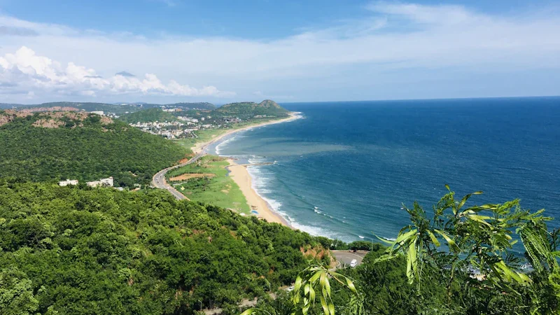
A port city between hills and the Bay of Bengal, known for its beaches, the Eastern Naval Command, a submarine museum and Simhachalam temple. More about Visakhapatnam →
Starting from Vijayawada? See what Vijayawada is known for.
Weather in Visakhapatnam
Forecast: MET Norway, CC BY 4.0
Bus, train & flight
Bus
State bus operators: APSRTC ↗.
Train
- Vijayawada: Vijayawada Junction
- Visakhapatnam: Visakhapatnam
Flight options
- Vijayawada: Vijayawada Airport (VGA)
- Visakhapatnam: Visakhapatnam airport options — confirm the operating airport and terminal with your airline
Things to do in Visakhapatnam
- Shopping: Jagadamba Junction markets
- With children: Submarine Museum
- For adults: Araku Valley coffee estate tour
Local food to try: Andhra thali (spicy) · Bongulo chicken.
What to see in Visakhapatnam
- Simhachalam Temple · allow 2 h
- Submarine museum (INS Kursura) and RK Beach · allow 2 h
- Kailasagiri hilltop park · allow 1 h 30 min
- Rushikonda Beach · allow 1 h 30 min
- Araku Valley and Borra Caves (a full day trip) · allow 10 h
Best time to travel
November to February. Cyclone risk on the coast is highest in the post-monsoon months, so keep dates flexible then.
Tips
- If you plan to visit Araku, stay a night in Visakhapatnam and start early.
- Try the local sweets in Rajahmundry, and pulasa fish in season.
Return trip: Visakhapatnam to Vijayawada
About 343 km back.
Plan Visakhapatnam → Vijayawada →
Visakhapatnam → Vijayawada route page: distance for this direction and a fuel calculator.
Vijayawada to Visakhapatnam: common questions
Does the Vijayawada to Visakhapatnam road go via Eluru?
Yes. The usual road goes via Eluru and Rajahmundry (NH16), about 343 km in total. You can add other stops in the trip planner.
How far is Visakhapatnam from Vijayawada by road?
About 343 km on the mapped road route (OpenStreetMap routing, checked 26 Sep 2026). The exact distance depends on where you start and finish in each city.
How much fuel does the Vijayawada to Visakhapatnam drive need?
Divide the distance by your car’s mileage (km per litre), then multiply by today’s fuel price. Enter both in the calculator on this page for the cost. We do not fill in a default mileage or fuel price, because both vary by car and by day.